Sunday, July 21, 2019

Mount Shasta (CA)

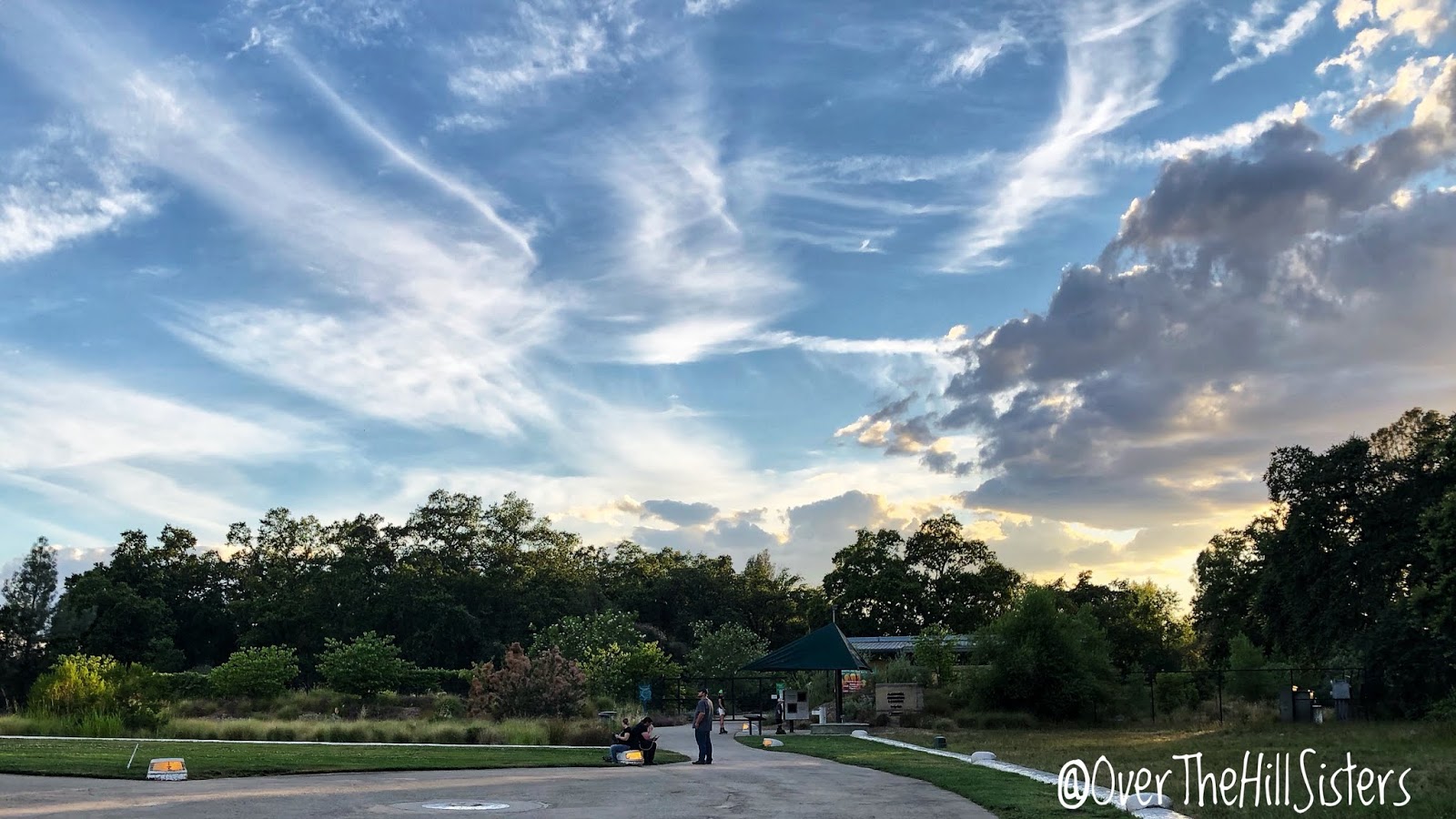
On 11 July 2019 we headed north on State Route 89 to camp near the spectacular Mount Shasta (CA) in the southern Cascade Range of Shasta-Trinity National Forest. When I lived in Shasta County as a teen and young adult, I saw Mount Shasta every day from my home about an hour south. I had seen it numerous times as I drove by on I-5, but I had never gotten as close as I did on this day. It really is such an impressive mountain/volcano. Mount Shasta and its satellite cone, Shastina, are visible from very far away, as it towers about 10,000 feet above its surroundings!

Mount Shasta from the McCloud area. Photo by Virginia.

Mount Shasta from the McCloud area. Photo by Virginia.

Margaret had hoped to camp at McBride Springs Campground, but all twelve campsites were filled when we arrived. We've been lucky, though, that this was the first time we weren't able to get a campground site without ever making reservations. We drove back toward Mount Shasta City, CA, for a cell signal and checked the Campendium app for alternatives. We decided to try for the highest open area to camp, which is adjacent to the Bunny Flat Trailhead (elevation 6,950 feet) on Everitt Memorial Highway. Bunny Flat dispersed camping isn't truly a campground. With dispersed camping, campers must bring everything needed and pack out all waste. The dirt access road and campsites had the finest and puffiest dirt I think I've ever been in. Margaret, Peaches, and I parked in the lot at the end of the highway and walked in to look for a site that would work for us. The dirt road was rough, rocky, and washed out in places. We found a site not too far in, and I stayed there while Margaret and Peaches went back to the Roadtrek. Margaret was able to maneuver into the spot after considerable effort; but as she was backing onto the leveling ramps, I noticed gasoline dripping from near the generator under the Roadtrek. Yikes! We had seen spots under the generator at Lassen but did not see it actually dripping. So after all the effort and getting our feet filthy (flip-flops!), we decided it was best to try and find out what was going on with the generator. So we headed back into Mount Shasta City where we parked overnight at an auto repair place. At least we had the chance to see Mount Shasta up close for a short time!

Mount Shasta and Bunny Flat Trailhead. Photo by Virginia.

The auto repair guy wasn't able to help us the next morning (other than to say it looked like a generator issue, rather than a fuel tank leak), but they did make a recommendation. Margaret contacted the recommended mobile RV guy, and he was able to look at the generator later that afternoon. Of course, the generator wouldn't leak, no matter what he tried! Grrr. Could it really have fixed itself (possibly the carburetor float unstuck itself)? We'll soon see...NOT(!) because it started dripping again! Margaret is considering replacing the current Onan generator with a nice, quiet Honda generator mounted above the rear bumper for easier access.

Black Butte from I-5 North. Photo by Virginia.

Since the camping thing didn't work out, we headed north to the town of Yreka, CA, to pick up some necessities. Then we headed back south a bit before cutting over to U.S. Route 97 North.

Mount Shasta from I-5 South near Yreka, CA. Photo by Virginia.

Mount Shasta from Montague, CA. Photo by Virginia.

Mount Shasta from Highway 97 intersection. Photo by Virginia.

I oohed and ahhed at every view of Mount Shasta as we drove further away. Then at 8:24 p.m. on the 82nd day of our Western States Adventure, we left California and drove over the Oregon border. Whew! California, you did us proud!

Lassen Volcanic National Park (CA)

After twenty-five days with our cousins in Redding, CA, we had our sights set on spending a few days at Lassen Volcanic National Park (CA); but first, errands: oil change for the Roadtrek and grocery shopping at two stores. I handed out a business card to employees at the oil change business and at Trader Joe's. Both of the ladies appeared very excited about our adventure and asked where we were headed, etc. Once stocked up on food, we left Redding (08 Jul 2019) where it was 88°, and headed east on California State Route 44. When we reached 2,000 ft. elevation, the temperature had dropped to 82°; and at 3,000 ft. elevation, it was 77°.

We stopped in Shingletown to gas up; and our next stop was the park entrance, where Margaret's pass got us in for free! Once we reached 5,000 ft. elevation, the temperature decreased to 70°. While Margaret was driving, I was taking photos and videos. We arrived at Summit Lake Campground North at 4:15 pm on 08 July, and it was a cool 68°. Yay! We found a lovely pull-through site and settled in. We were surrounded by huge pine trees and were very close to Summit Lake. The campground had flush toilets, showers, picnic tables, fire rings, and very recently had the potable water line repaired; so we had drinking water, too!

Loomis Ranger Station at Lassen Volcanic National Park. Photo by Margaret.


A short movie of Lassen Volcanic National Park by Virginia.
[If you have trouble viewing this embedded movie, 
you may view it directly here: https://youtu.be/clMsLyooCe0]

Chaos Crags from the moving Roadtrek. Photo by Virginia.

Lassen Peak from the moving Roadtrek. Photo by Virginia.

Lassen Peak from the moving Roadtrek. Photo by Virginia.

Between the two of us, we saw a number of unusual (to us) birds while at Summit Lake: male and female American Goldfinches, Stellar's Jays, Mountain Chickadees, Western Tanagers, and Dark-eyed Juncos. We noticed a few squirrels and quite a few chipmunks. One chipmunk, in particular, put on quite a comedic show for me one afternoon. I saw a park newsletter moving jerkily up and down at the base of a tree. When I got closer, I saw it was a chipmunk shredding it up for its nest! The paper was several times larger than the chipmunk, but it didn't want to give up. It took off when I got too close; and, sadly for the chipmunk, I disposed of the paper in the waste receptacle. Later on that day, I saw a chipmunk racing up the campground road with a huge piece of paper in its mouth. Same chipmunk? I bet it was!

Each morning before the other campers and day use visitors arrived, I walked down to Summit Lake and took in the quiet, glassy, and clear lake. (Check out the movie above to see and hear what I did.) If you look at the enlarged images, you can see the rocks under the water and the clouds, vapor trails, and trees reflected in the surface of the lake. It was absolutely stunning!

A clear and glassy Summit Lake in the early morning. Photo by Virginia.

A glassy Summit Lake early in the morning. Photo by Virginia.

Summit Lake. Photo by Margaret.

Summit Lake. Photo by Margaret.

Since it got a little warm for us in the afternoon, Margaret wanted to deflect some of the sun by hanging up the space blanket and Aluminet we brought, which really does seem to help knock off a few degrees.

I sat outside reading and enjoying the sights for as many hours as possible each day, but the mosquitoes were a real problem. I noticed many campers spraying themselves with insect repellent, but I would rather go inside than be all oily and smelly.

The Roadtrek decked out to keep cool! Photo by Margaret.

Peaches sure has taken to life on the road. She truly enjoys her adventure walks with Margaret, but she prefers being off of the floor when inside and up on other things when outside. She jumped up on the step stool and backed in between my feet one morning. Several times, actually. :>)

Peaches. Photo by Margaret.

Peaches, the contortionist. Photo by Margaret.

I had made a double batch of vegetable tofu scramble and Potatoes O'Brien, which meant we had plenty of leftovers for breakfast burritos! (I sprinkled a little Daiya Cheddar over mine.)

A breakfast burrito made with vegetable tofu scramble, potatoes, and Daiya Cheddar. Meal and photo by Virginia.

On our second night at Summit Lake, I made the most "gourmet style" dinner yet: Mushroom Stroganoff (vegan) over organic whole wheat fusilli pasta. I wanted asparagus in a lemon and herb sauce and lucked out when I found a packet of ready-made skillet sauce with "real" ingredients at Safeway. They were both really delicious and complemented each other beautifully. There was even enough for second helpings.

Mushroom stroganoff and asparagus in a lemon & herb sauce. Dinner and photo by Virginia.

Sunset (09 July) through the window above my bed! Photo by Virginia.

On our way out of the park on 11 July 2019, we stopped at the Loomis Museum, where there were rangers on duty to answer questions, a documentary movie playing throughout each day, and lots of exhibits, books, and postcards. This area has a fascinating history. The names that are bolded in the post are links to either Wikipedia or park service webpages where you can find out about them.

Our next camping adventure didn't work out as we had hoped; but we still got really close to another big, beautiful volcano in the southern Cascade Range.

Saturday, July 6, 2019

Sundial Bridge & Redding, CA

After leaving Potato Patch Campground (13 Jun 2019), we drove to Chico and headed north on Highway 99. Driving through the miles of orchards felt very familiar to me, as I lived and worked in Shasta and Tehama Counties many years ago. Whereas the temperatures were in the 80s up at the campground, we watched it climb to 103 degrees before too long. The area has changed a great deal since I was last there, but there were enough familiar streets, buildings, and landmarks to spark quite a few memories.

We have been staying with our cousins in Redding, CA, (camping in their side yard with electricity!) for more than three weeks. During that time, we chatted, went out to dinner a couple of times, made dinner a couple of times, used the heck out of their Wi-Fi, had showers, did laundry, took advantage of the abundant variety of stores in which to shop, and Margaret had work done on the Roadtrek. We were also taken to see Burney Falls (15 Jun 2019), Shasta Lake (03 Jul 2019), and the stunning Sundial Bridge (27 Jun 2019) in the Turtle Bay Exploration Park on the Sacramento River.

Sundial Bridge from the south. Photo by Margaret.


Sundial Bridge from the south. Photo by Margaret.

Sundial Bridge. Photo by Margaret.

Sacramento River sunset from Sundial Bridge. Photo by Virginia.

The Sacramento River and Lassen Peak from Sundial Bridge. Photo by Virginia.
.
The Top Curve of the Sundial sculpture. Photo by Virginia.

The Sundial sculpture from below. Photo by Virginia.

Sundial Bridge dedication plaque. Photo by Margaret.

The Sundial sculpture. Photo by Margaret.

Sundial Bridge and the Sacramento River. Photo by Virginia.

The entrance to McConnell Arboretum & Botanical Gardens. Photo by Virginia.

We'll be leaving Redding and our cousins very soon and heading up to cooler climes. We won't have a cell phone signal or Wi-Fi or electricity; but we'll have the mountains, lakes, trees, wildlife, and views that recharge our souls. We'll catch you all up when we have a strong enough signal or hit up some public Wi-Fi. Take care, and enjoy where you are!

Wednesday, July 3, 2019

Shasta Lake & Shasta Dam (CA)

The first time I laid eyes on Shasta Lake was in the summer of 1977. What I most remember is the huge amount of earth showing that should have been under water. The lake was at the lowest point in its history—nearly 250 feet below its normal depth! Its "full pool" shoreline length of 365 miles was reduced to about 124 miles. Such is definitely not the case now. Shasta Lake is gloriously and amply full! Since October 2018, Shasta Dam has received about 88 inches of rain, which is about 42% more than average. Roughly 90% of the water retained in the reservoir is from rainwater. So, the increased rainfall did its job!

Shasta Lake (Mt. Shasta in the center background). Photo by Margaret. 

Our cousins took Margaret and me to see the lake and dam on 17 June 2019. My sister had not seen it up close prior to this day but, rather, saw only glimpses as she was passing by on I-5. On this visit, it was a very clear and temperate day. There was also lots of shade provided by the huge trees surrounding the Bureau of Reclamation's Shasta Dam Visitor Center—all in all, a very pleasant day to take photos.

A negative side effect of the full lake is the driftwood and other debris that is lifted off the shore as the water rises. Shasta Lake. Photo by Virginia.

A clear view of Mt. Shasta from just southeast of the dam. Photo by Virginia.

The crest of Shasta Dam with an area of the Shasta-Trinity National Forest (background) that burned in the Carr Fire in July 2018.  Photo by Margaret.

Shasta Dam and its spillway from inside the visitor center. Photo by Virginia.

The Sacramento River is the primary outflow of Shasta Dam. Photo by Virginia.

Whiskeytown–Shasta–Trinity National Recreation Area and the Sacramento River southwest of the dam. Photo by Margaret.

As we were walking around taking in the beauty and lots of photographs, we noticed a deer casually strolling across Lake Blvd. to a grassy area near the visitor center. It did not appear to be affected by the close proximity of humans, a couple of which were taking its photograph from just a few feet away. It stayed, calmly grazing, in the shade of a huge fir tree even after we had moved on.

We looked at the displays throughout the visitor center and watched a 21-minute version of the documentary, Shasta Dam, California's Empire Builder, which was fascinating! I would very much like to see the 80-minute full-length version of the documentary someday in the future. During a quick walk-through of the gift shop, I bought a postcard for my daughter before going to meet our cousins.

It was a visit that I will hopefully remember more than my previous one. Documenting it here with photos and details should help, I think. :>)