Wednesday, June 26, 2019

Burney Falls (CA)

I think the place Margaret and I both had on the top of our "places to visit wish lists" while here in Redding (California) was Burney Falls. Margaret had planned to visit there after the stay with our cousins was over, but our thoughtful cousins offered to take us themselves to McArthur-Burney Falls Memorial State Park. They've lived up in this area for many years, and John knows where everything is. It was just a hop, skip, and a jump from their home to the falls in their quiet, smooth, and cool car. We stopped briefly at the Burney Mountain Vista Point which overlooks a lush valley with Burney Creek winding through it. The backdrop was Burney Mountain, with Lassen Peak in the distance. It was quite the view!

Panorama of Burney Mountain and Lassen Peak (right rear). Photo by Virginia.

Decades ago, I lived in Shasta County for several years; and for some reason, I never made it to Burney Falls. Even as a young person, I appreciated the natural beauty and sought it out; but I truly feel I have a greater appreciation for the falls now, as a senior. They are astonishingly beautiful and most definitely worth waiting for! It was about 85° F at the Falls Overlook the afternoon we visited—pretty warm for us. Margaret and I first thought to view the falls strictly from the overlook, but we ultimately decided to walk down the Falls Loop Trail to get up close. The stroll down wasn't the issue, of course. It was the return trip up in the heat we were both taking issue with. However, as anyone who has been at the base of the falls knows, it is much cooler down there in the mist—maybe 20 degrees cooler!

Burney Falls from Falls Overlook. Photo by Virginia.

At a height of 129 feet (or 114 feet, according to the World Waterfall Database), Burney Falls isn't the tallest or largest waterfall in California; but it just might be the most beautiful. The hundreds of springs that seep out of the cliffs create a wall of falls some 250 feet wide! The water from those springs appears almost... lace-like. (Zoom in on the photos to see for yourself.)

Burney Fall from Falls Loop Trail. Photo by Virginia.

Burney Falls from Falls Loop Trail. Photo by Margaret.

Burney Falls from the Falls Loop Trail. Photo by Margaret.

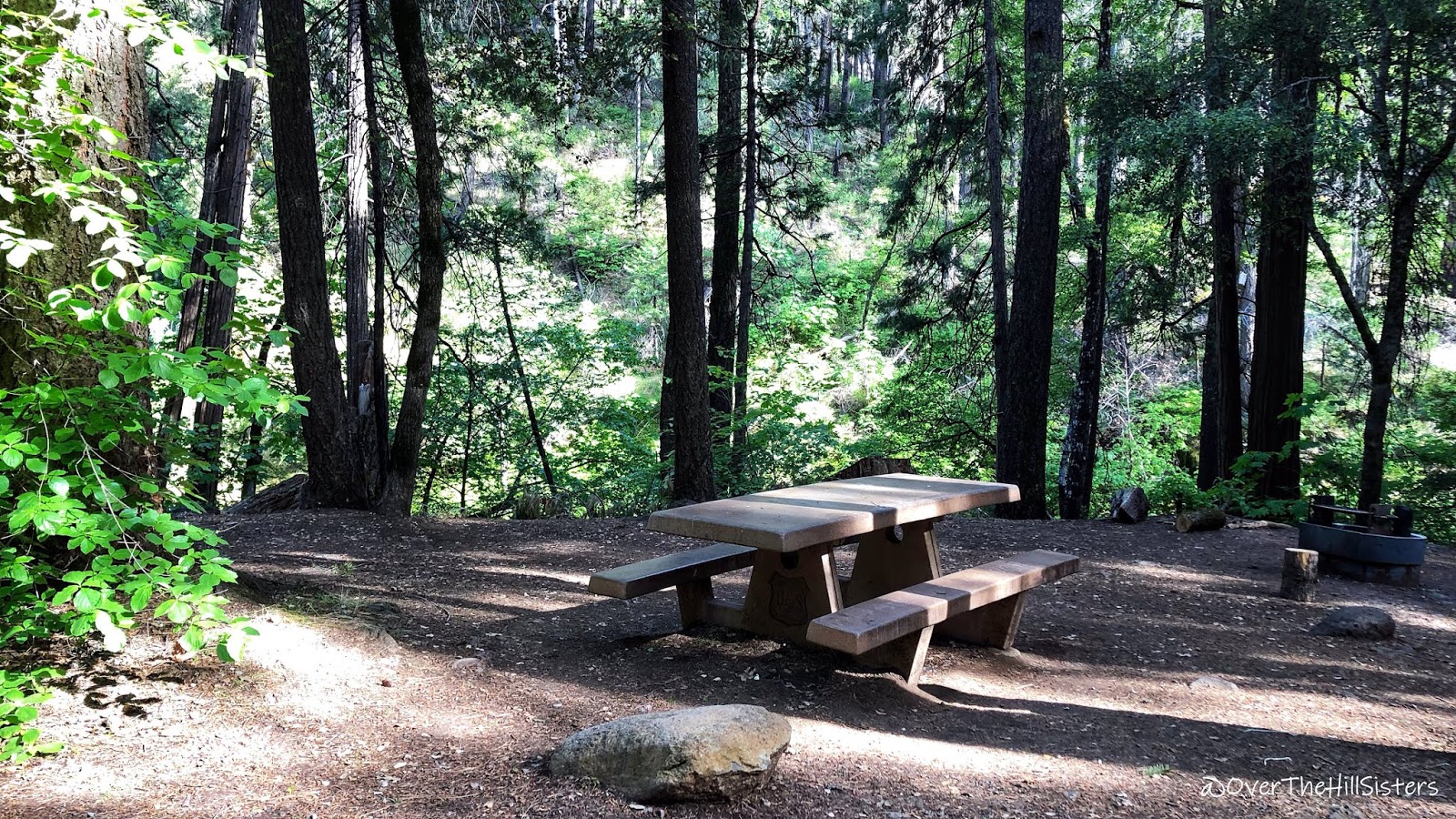
Margaret and I hadn't planned to leave our cousins (who were seated in the shade near the Falls Overlook) for as long as we did. We spent only a few minutes near the base of the falls before walking the loop trail beside Burney Creek down to Rainbow Bridge. After just a few minutes there, we decided it would be a quicker route back to them if we turned around rather than proceed further on the loop. It was on the way back that Margaret tripped and fell on uneven rock steps. I had walked ahead about twenty feet before I realized she wasn't right behind me. When I glanced behind, I immediately saw her on the ground but also noticed several young people helping her. A young man helped her up, and a young woman offered up first aid from her small kit. How kind they were! With a bandage and antibiotic cream covering the scrape on her elbow (she also had a scrape on her knee hidden by her dress), and after many thanks to those who came to her aid, she and I walked off arm-in-arm, stopping to sit on shady benches every so often to cool off and catch our breaths. John and Annette had moved the car into a shady spot, and John came looking for us at the top of the trail as we returned. It was ever so nice getting into their air-conditioned car and drinking the icy water from our Yetis. They took us for a quick sightseeing drive through the park and campground area before briefly stopping to show us Burney Lake. Then we were on the way back to our home on wheels—the Roadtrek—which is "vacationing" in our cousins' side yard. Thank you, Cousins!

Burney Creek from Falls Loop Trail. Photo by Virginia.

Burney Creek and Rainbow Bridge. Photo by Margaret.

Burney Creek from Rainbow Bridge. Photo by Margaret.

Burney Falls and Creek. Movie by Virginia.
[If you have trouble viewing this embedded movie, you may view it directly here: https://youtu.be/JDDqPj9TGvI]
 
Our cousins took us to another place on our list just two days later. It was yet another day filled with appreciation and awe!

Tuesday, June 25, 2019

Potato Patch Campground (CA)

We left Boca Campground on the morning of 09 June 2019 and continued north on State Route 89, crossing over the Little Truckee River several times. We drove through the area of Sierraville, CA, which was predominantly lush grazing land—miles of it! There was a little resort town called Graeagle, CA (pronounced gray eagle), which was adorable to drive through; but, dang, I kinda wish we could have parked and walked around a bit. There were a lot of tourists taking advantage of the cool, clear day to take in the cute little shops and restaurants—another gem I had never heard of prior to this day. Just beyond Graeagle, we turned west on State Route 70, which would take us through the Beckworth Pass to the western side of the Sierra Nevada. We stopped in the cute town of Quincy, CA, to stock up on groceries at Safeway. Before long, we were back on Highway 89 and headed north, remaining in the Plumas National Forest. No matter how many stunning sights we have seen on this trip, we are still rendered spellbound when we see bodies of water like Indian Creek near Crescent Mills, CA, (pictured below), particularly when they are just there—next to highways and other "mundane" routes that people use to get from Point A to Point B. I mean, just look at this creek that was meandering along the highway for miles. I don't ever want to be so unimpressed with a natural wonder such as this that it becomes mundane for me! Margaret stopped in a nice wide spot off the highway so I could get out and take it all in—the sights, sounds, and feel of such a pristine and powerful waterway rushing by me!

Indian Creek, Crescent Mills, Plumas National Forest. Photo by Virginia.

The next sight that had us pulling off the highway to investigate was Lake Almanor (CA), a large reservoir in northwestern Plumas County, but with much of its southern shore in the Lassen National Forest. We walked down to a cove where families were picnicking and cooling off in the water—nice but noisy on that Sunday afternoon. It was just a quick stop, so on we went.

A Lake Almanor recreation area. Photo by Margaret. 

Indian Creek, Lake Almanor, & Potato Patch Campground. Movie by Virginia. 
[If you have trouble viewing this embedded movie, you may view it directly on YouTube here: https://youtu.be/v91g4arRT9I]
 
After leaving Highway 89 to travel west on Highway 36, we caught a quick glimpse of Lassen Peak (photo in the video above), near the town of Chester, CA. Then before too long, we turned onto State Route 32, which is where our next campground was located. Yippee, the highway and surrounding forest were really pretty! I could tell because we were arriving early enough this time to actually see everything!

Potato Patch Campground sign. Photo by Virginia.

When we arrived at Potato Patch Campground, we saw the perfect campsite; but there was a truck parked in it. Darn! We drove through the campground (which has 32 designated campsites) but didn't see another one we liked as much. Imagine our delight when we again drove around the loop a few minutes later and saw that the truck was gone! I checked the registration stub on the campsite post; and woo-hoo, he had only paid for one day. Boom! Margaret backed the Roadtrek in lickety-split. Talk about perfect timing!

The Roadtrek in campsite 6. Deer Creek is beyond the trees at the left. Photo by Margaret.

 
The Roadtrek under the towering trees. Photo by Margaret.

You can see how ideal the campsite was. We were accustomed to having creeks and lakes nearby, but having potable water in a campground? It has been a bit of a rarity for us. Icy cold mountain water came out of a spigot right in our campsite...yes! Then there were the towering pine and fir trees, the vault toilets, the trash, and recycling. Oh, and there was the creek just a few feet away. Yes, a creek! Deer Creek (CA) had a nice little fall and boulders that upped the rushing water sound right next to our campsite. I love that sound; don't you? There was another thing about this campground that we were sadly getting entirely too used to no cell phone signal. Zip! Nada! However, according to information on the campground bulletin board, there was a pay phone a few miles away....

Our Potato Patch campsite #6. Deer Creek is just beyond the trees. Photo by Virginia.

Deer Creek beside our campsite. Photo by Virginia.

Deer Creek beside our campsite. Photo by Virginia.

Deer Creek beside our campsite. Photo by Virginia.

The campground entrance. Photo by Virginia.

It was such a quiet and pretty location, we decided to stay for four nights. We had been up in the higher elevations (closer to 7,000 ft.) and were now at 3,400 ft., and it felt like it. It was in the 80s during the day and down only into the 60s at night. The insects were out in minor force, so I had to retreat inside around noon each day.

Something happened while we were camping here that kind of took the happy away, though. Margaret started feeling very ill and in a lot of pain on the day after our arrival. Man, she was miserable. She stayed in bed, didn't want to eat, and experienced severe nausea and vomiting, along with agonizing pain. I asked if she wanted me to take her to an emergency room; but she had experienced similar symptoms a year ago and declined, saying she would go to an urgent care facility if she felt she needed to. She rested; and I kept busy with little chores like filling our drinking water, emptying the trash, sweeping out the Roadtrek, checking on her, and walking Peaches. I walked around the campground (smiling and waving at the friendly campers), read six books, edited photos, and made a movie or two—all the while waiting for Margaret to feel better. Fortunately, she started improving a bit and was able to eat a little something late on our third day there. 

Our scheduled departure date arrived, and Margaret decided she was well enough to drive. Our next planned stop wasn't a campground, though. Oh, no. Rather, we were going visiting! We were going to stay with a first cousin once removed and her husband in Redding, CA. We used to visit them fairly often when we were children, but the last time we had seen them was in 1986! =:>)

Civilization. Conversation. Conveniences. Heat. It's all here! Wi-Fi, too. Yes!

Sunday, June 23, 2019

Boca Campground (CA)

Margaret once again relied on one of our most used resources, California Boondocking: The Desert and Eastern Sierra—A Frugal Shunpiker’s Guide by Marianne Edwards, for our next camping location. After our grocery shopping in Tahoe City, we headed east on Interstate 80, hoping the road over Boca Dam was open to access Boca Campground. The U.S. Forest Service Website information hadn't been updated for over a year, but it was definitely past snow season, and we figured the dam road should be open by then. However, it turned out that the dam was under construction, so the road remained closed. (Bummer!) So we went back from whence we came; and using the GasBuddy app, I found the lowest priced gasoline to fill up the Roadtrek. That bargain gas station happened to be located in the Historic District of Truckee, CA. What a quaint, fascinating, and crowded few blocks it was. (The immediate area of the gas station was made even more crowded by an Amtrak passenger train that was waiting to depart and was blocking the road.) I think if it wasn't so late, and if we could have found a parking spot large enough, we would have explored the town. As it was, it was nearly 7:00 p.m.; but we thought we had plenty of time before dark to get to the campground and find a campsite. Hah!

Between the directions from the U.S. Forest Service Website and Google Maps, we determined the alternate route to the campground was by way of Highway 89. The highway miles sped by; it was the several miles on dirt roads that presented us with challenges. At a complicated intersection of dirt roads, Google Maps ended up rerouting (unbeknownst to Margaret, the driver). There were California Highway Patrol officers blocking the forest road straight ahead (along with a detainee in handcuffs!). Continuing to follow the app's directions, we turned to the right there and ended up on a jeep track, which was narrow, rocky, and washed out in places. The Roadtrek is not an offroad vehicle, and we were riding high on either side several times to avoid bottoming out. Things were getting tossed about in the back, but Margaret did well maneuvering, and we didn’t tip over. My anxiety levels go through the roof in times like those, but Margaret remained calm and capable. It had been a very long day, my knee was throbbing, and a short scouting walk ahead on that trail hadn't helped it any. The jeep trail didn't look right to either of us and got muddy where I scouted ahead, so Margaret made a safe three-point reverse and returned to the four-way dirt intersection.

The Roadtrek in our little campsite with a beautiful view! Photo by Virginia.

We got back to the main forest road; and with the little bit of a cell signal we had (and another Google Maps rerouting), we ended up seeing a sign with an arrow to Boca Reservoir. Yay! It was another three miles before we saw the Boca Campground sign. By that time, it was pretty dark; and the right fork of campsites was full. We drove over to the left fork and were able to find an unreserved campsite in the dark. One of the picnic table's two benches was utterly destroyed, but we didn't care since we rarely ever use them. This time, though, it came in handy right next to our side door for temporarily offloading the groceries we had purchased, which allowed more room to move things from travel mode into living mode. It was after 9:00 p.m., and we had had a really full day. While Margaret and Peaches walked back to the self-pay station to deliver the registration form and fee, I got the Roadtrek ready to camp. Fortunately, we had enough of a fluctuating T-Mobile signal that I could call and check on her, as they were gone for quite a while and it was d-a-r-k! On top of being fatigued, tired, and sore, I was also "hangry." I heated up an Amy's frozen enchilada meal in the skillet and ate dinner at 11:15 p.m. Margaret and Peaches finally returned from their long walk, and soon we all crashed!

Things always look better in the morning after a few hours of sleep, right? In this case, that's a "you betcha!"

A short movie of Boca Campground and Reservoir by Virginia.
[If you have trouble viewing this embedded movie, 
you may view it directly here: https://youtu.be/bSDQiWP7M7U]

The forest, Boca Reservoir, and mountains. Photo by Margaret.

Boca Reservoir and the Western Sierra Nevada Mountains. Photo by Margaret.

Boca Reservoir and the Western Sierra Nevada Mountains. Photo by Virginia.

Boca Reservoir. Photo by Virginia.

Our neighboring campsite during the brief time it was unoccupied. Photo by Virginia.

This beautiful campground ended up being the busiest and loudest of any place we've stayed on this trip so far. We were probably the only "outsiders." (I got a real local and regular vibe from all of the much younger campers that surrounded us.) We were definitely the most, um, mature campers there. 

We stayed for three nights, the first being the only relatively quiet one. This campground (while we were there, anyway) was not for the peace and quiet crowd. There were loose dogs barking and getting into fights, loud music, people shouting, and OHVs zipping in and out of camp—all of which were forbidden but not enforced. Was I ever that young and fun-loving? I think not! In fact, I don't know if I've ever felt older and crankier. They all seemed to be having a grand young time, though. ;>) 

[This paragraph contributed by Margaret:]  One morning when I was walking Peaches in the campground, one of the chronically loose dogs (a large, part German Shepherd puppy) saw Peaches and suddenly ran straight toward her. Peaches was on a leash, as always in public. When that dog got to her, Peaches didn't hesitate. She lunged upward at that dog's face and bit its left flew ("lip").  Wow! I guess Peaches knows how to take care of herself! That dog's eyes got so large; he acted completely surprised—like, "Why did you do that? I just wanted to play!" When the other dog got detached, he hightailed it back to the guy that had the adult German Shepherd with him. I wouldn't have wanted to stretch Peaches' luck with that dog. All other walks with Peaches were uneventful. Whew.

It really was a beautiful location, though; and it was definitely not too warm for our comfort. Margaret took Peaches for a long walk each day; and I, who am almost always too warm, was chilled to the bone even sitting in the sun during the late morning. I still managed quite a few hours outdoors reading back-to-back Harry Bosch books on my Kindle. The books were exceptional, but the brief glances at my surroundings only enhanced the gritty fictional world created by Michael Connelly. Ahh, the best of both worlds!

On the way out, we spotted this absolutely perfect meadow carpeted with purple flowers. Such a truly lovely way to bid us adieu, yes?

Meadow on Old Reno Road, Truckee. Photo by Virginia.

Regarding the reservoir's low water level: I read later that the reservoir was operating at about half of its capacity (about 28 feet down) during the construction to make the earthen dam more resistant to earthquake damage.

Thursday, June 20, 2019

Lake Tahoe Basin (CA)

We arrived at an unnamed free U.S. Forest Service campground off of Luther Pass on 05 June 2019 after dark, but the drive to get there was very scenic. We left our previous location after squeaking out every last minute on their public Wi-Fi. Continuing north on Highway 395, we stayed in California by driving west on Highway 89 and finally to Highway 88 (versus continuing north and entering Nevada). The route was certainly quiet. I think we may have passed only a half-dozen other vehicles during the approximately 40-mile trek through the mountains. We drove through the Carson Iceberg Wilderness, and the West Fork Carson River wound its way beside and under the highway for several miles. At one point, coming slowly around a corner, there were five deer on the left shoulder probably no more than 40 feet away from us. Margaret stopped the Roadtrek, and three of the deer crossed in front of us and straight up the cliff to our right. The two remaining deer split up—one going down the cliff to our left and the other following the first three up on our right. They were remarkably agile and out of sight in a flash!

It was so dark when we arrived at the Forest Service campground that we ended up driving through the entire campground and turning around to try and spot a campsite because we could only see a short distance beyond both sides of the road! This campground is better suited to tent campers, but we managed to find a fairly level parking spot for the night (which turned out to be a campsite, we realized in the light of day). The one nice thing about arriving after dark was stepping outside first thing in the morning and seeing just how wondrously majestic it was in the light of day. Wow! It was definitely take-your-breath-away beautiful! The huge Jeffrey Pines were so healthy, lustrous, and aromatic! Oh, and there were springs and creeks seemingly everywhere! Margaret and I both wonder why such a magnificent campground hasn't been named. Get on it, powers-that-be; this heavenly spot deserves a special name!

The view from our campsite. Photo by Margaret.

The Roadtrek in our overnight campsite. Photo by Virginia.

Breakfast with the trees and rocks and the view! Photo by Virginia.

She caught me unawares while I was breakfasting. Photo by sneaky sister, Margaret!

A short movie of forest sites and sounds. Videos & photos by 
Margaret and Virginia. Movie by Virginia. 
[If you have trouble viewing this embedded movie, 
you may view it directly here: https://youtu.be/NKcXN19g5Yo]

We left our overnight campsite at 11:00 a.m. the next morning and drove northwest on Highway 89 to take in the splendor that is Lake Tahoe. Margaret had seen it many years ago, but I never imagined being able to see it for myself. Being the passenger has its advantages, such as looking out the windows so I could catch that first glimpse of this unique alpine lake...wow! *chills* All of it is remarkable: its size, depth, clarity, stunning blue color, panoramic setting, and geological formation all contribute to making it a natural wonder not to be missed. And thanks to my sister and our decision to hit the road, I didn't miss it!

We attempted to visit the Taylor Creek Visitor Center, mainly to get one of the all-day parking passes but found it was only open on the weekends until the end of June when it would then be open every day. We walked around a little, mainly reading signs, but also taking in the scenery, before moving on. The next stop was Inspiration Point (above Emerald Bay), which was extremely crowded. Even though visitors are not supposed to park along Highway 89, the parking area and highway were crammed. We lucked out and got a parking spot without too long of a wait. I have to say that the name of this lookout is appropriate, for the view is inspiring—jaw-dropping, too!

Emerald Bay and Lake Tahoe from Inspiration Point. Photo by Margaret.

Emerald Bay and Fannette Island from Inspiration Point. Photo by Virginia.

Just a few miles north, Margaret noticed that Sugar Pine Point State Park was open for tours (and parking passes, too!). I'm so glad we stopped and explored there. I hadn't done much reading about the area (kinda wanted to be surprised, I guess), but what a beautiful area!

Sugar Pine Point State Park sign. Photo by Margaret (with Va's iPhone!).

We parked in the shade and turned on the generator and A/C for Peaches. Margaret and I walked to the nature center and then over to the Hellman-Ehrman Mansion. (If I ever go back to this area, I want to take the tour of the mansion; but at $10 per adult, it was too expensive for me.) The house is situated very prettily on a hill overlooking the lake. The grounds were immaculately kept; the walking paths, seating areas, picnic tables, and pier all afforded the most amazing views of the lake and the Western Sierra Nevada Mountains. The weather was in the high 60s, the sky was an unreal shade of blue, and the lake? It is indescribably crystal clear. Margaret and I both walked down some stone steps into the water. The surface water temperature was probably in the mid-50s, so just a bit chilly but totally worth the slight chill to be in Lake Tahoe. Had we been aware of how quiet this area was to sit and reflect, we would have packed in our lunches and gawked while we ate. Instead, we sat on a bench under the Jeffrey Pines and gawked without eating. :>)

The Hellman-Ehrman Mansion (Pine Lodge). Photo by Margaret.

The Hellman-Ehrman Mansion (Pine Lodge). Photo by Margaret.

One of the boathouses and pier. Photo by Margaret.

The stunning view of Lake Tahoe from the mansion's lawn. Photo by Margaret.

Canada Geese on Lake Tahoe from the pier. Photo by Margaret.

Lake Tahoe with the Western Sierra Nevada Mountains. Photo by Virginia.

A panoramic view of Lake Tahoe, pier, and Western Sierra Nevada Mountains. Photo by Virginia.

A short movie by Virginia with photos from Margaret and Virginia,
and videos by Virginia.

We ended up eating lunch in the Roadtrek before continuing north to Tahoe City, where we shopped at Safeway. After stocking up on lots of fresh produce and other goodies, it was time to get on the road to our next campground. That turned out not to be as easy as it had been in the past. There were a number of challenges, and for me, quite a bit of anxiety. Stay tuned for the details on that and much more unbelievably beautiful scenery in our next post. Thanks for coming along with us!

Tuesday, June 18, 2019

Humboldt-Toiyabe National Forest (CA)

After a long day driving and sightseeing at Mono Lake Park and Bodie State Historic Park on 02 June 2019, we were more than ready to stop and camp somewhere beautiful, quiet, and hopefully with a cell signal. One of our regular sources (California Boondocking: The Desert and Eastern Sierra—A Frugal Shunpiker’s Guide by Marianne Edwards) had recommended an area of free dispersed camping in the forest not too far from the town of Bridgeport, CA. After a brief stop for gas and goodies in town, we headed southwest up into Humboldt-Toiyabe National Forest (toi-YAH-bee) in the direction of Buckeye Hot Springs. Once we left the maintained road, the gravel forest road was a bit rough and quite steep in places; but the directions we had were concise, and we found a beautiful spot to camp under the trees. There were two other groups camping nearby when we arrived, but they were respectfully quiet. We also had two out of four bars LTE, which was a real treat. Especially given how remote it felt.

The Roadtrek, shaded by the towering Jeffrey Pines. Photo by Margaret.

Each of the three nights we stayed, at right around 8:00 pm, several deer grazed their way by our campsite. I wasn't able to get good-quality photos or videos of them, but I will post some to our West Coast States Adventure album on Flickr if you want to see these beautiful creatures. Our home base is in a desert area of southern California; and that makes being in the forest, shaded by trees and surrounded by so much water, a very special thing. The sounds, smells, and sights are quite different from our home base. The weather during the day averaged around 70 degrees with gorgeous clouds in clear blue skies. The evenings were in the 40s, which made our entire stay comfortable. Feast your eyes on the stunning views!

South toward the Hoover Wilderness. Photo by Virginia.

Healthy, aromatic, and shimmering pine trees! Photo by Virginia.

The Bridgeport Valley and Bodie Hills. Photo by Virginia. 

Southeast of our campsite. Photo by Virginia.

The Bridgeport Valley and Bodie Hills. Photo by Virginia.

The Bridgeport Valley and Bodie Hills. Photo by Virginia.

Mountains southwest of our campsite. Photo by Margaret.

On the morning of 05 June, we left this paradise for the senses to use the public Wi-Fi at the Bridgeport Library. We were parked there for more than seven hours working to catch up on blog posts, uploading and downloading content, and generally wanting to rush when the Wi-Fi was anything but fast. We were able to publish two posts before leaving at 6:30 p.m. for the rather long drive to our next overnight camping spot. The blog entry featuring that campground and all the beauty that followed for several days is coming soon. Yay for fast Wi-Fi! Thank you for reading!

Sunday, June 16, 2019

Mono Lake Park & Bodie State Historic Park (CA)

After three nights camping on Grant Lake, it was 02 June 2019 and time to move on. We had just a few miles to drive to see the lovely little Mono Lake Park. We walked around the park oohing and ahhing over its lushness and the creek running through it. Margaret walked Peaches around in the grass, which turned out to be the ideal rolling stuff for her (see in the video below). It was a beautiful day of about 65 degrees, with blue skies with puffy white clouds, a slight breeze, and mostly just the sounds of birds and running water to hear.

 Mono Lake Park. Photo by Virginia.

  Mono Lake Park. Photo by Virginia.

  Mono Lake Park. Photo by Margaret.

 The boardwalk takes you to Mono Lake Tufa State Natural Reserve. Photo by Margaret.

 Tufas along the boardwalk. Photo by Virginia.

 More tufas along the boardwalk. Photo by Virginia.

 Some Canada Geese on the shore of Mono Lake. Photo by Margaret.

 A short video featuring the park, Peaches, & the reserve. 
Videos by Margaret & Virginia. 
Movie by Virginia.
[If you have trouble viewing this embedded movie, 
you may view it directly on here: https://youtu.be/tnHB57mEj60]
 
Following a lovely picnic lunch at Mono Lake Park, we continued north on Highway 395, intent on visiting the ghost town of Bodie, which was a gold-mining town founded in 1876. Bodie State Historic Park is located ten miles east of 395 off of State Route 270. The last three miles are gravel with washboarding, potholes, and no railing. I was the nervous passenger with the view down the steep cliff, while Margaret was all "Don't worry; we're not going to go over." Hah! Of course, we made it there and back without going over any cliffs, but I was still freaked out. =:>)

Bodie is located at an elevation of almost 8,400 feet, and the June day we visited felt more like March. It was in the mid-50s upon our arrival; but while we were there, the windchill factor dropped the temperature considerably. Then there were the sporadic rain and hail showers. Brrrrr! Both Margaret and I would have loved to have stayed longer and continued walking more of the town, including the Museum & Visitor Center, but we didn't want to get any colder and wetter. (The town and mining operations are scattered in a rather large area.) We also missed out on the Stamp Mill Tour, but we did manage to watch the video, Bodie: Frozen in Time at the Red Barn. Bodie's history is colorful and interesting. There are links to its Wikipedia page and the state park site in the paragraph above. It is fascinating reading.

The entrance to Bodie State Historic Park. Photo by Virginia.

The really cool welcome sign in the parking area. Photo by Virginia.

Boomtown Bodie sign. Photo by Margaret.

Head frame and elevator cars. Photo by Virginia.

Bodie landmark plaques. Photo by Margaret.

The interior of the Methodist Church, including the organ. Photo by Margaret.

A view of the northwest area of Bodie. Photo by Virginia.

The interior of the D.V. Cain House through a window. Photo by Virginia.

The west end of Bodie, including the Methodist Church. Photo by Virginia.

The Standard Mill on the east side of Bodie. Photo by Virginia.

We were on site for nearly an hour and a half before heading back over the treacherous (slight exaggeration...maybe) road back to modern-day civilization by way of the quaint historic town of Bridgeport, CA. Once there, we went from no cell service to four out of four bars LTE, which was announced by many notification update sounds. Hallelujah! Our next camping experience was high up in a forest with stunning views of the mountains and Bridgeport Valley. Stay tuned for that entry—coming soon. Thanks for following our adventures. We truly appreciate your support!